Agrispray have teamed up with Land Insights. Simplifying the capturing of data, planning, mapping & reporting process for you.
In March 2021, the government announced there would be changes to wintering requirements – changes like these are happening more often and technology & data will be significant to the future of farming.
How we can help:
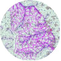
Water catchment and flow
Show all of your land, where the water flows to and accumulated flow. We use the Strahler modelling algorithm to show how captured water is naturally handled.
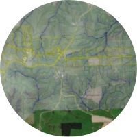
1km buffer
The 1km buffer map shows water catchment and water flows in relation to your farm, where it flows from neighbouring property, as well as where it flows as it exits your property. Zoom in to inspect property boundaries.
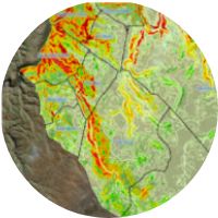
Steepness
Investigate slopes in order to see if a grazing permit is required. This can be difficult to work out but by using your farm map (supplied by you) we can break the slope of your farm into 5° wedges, and show each paddock both as square meters and percentage of area.
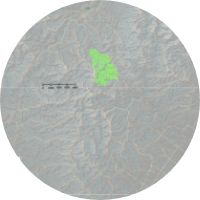
General location
Examine waterways and rivers on and surrounding your property as well as public land, caves and mines. We can also include a snapshot of key weather statistics such as rain, wind maximum/minimum and ground temperature.